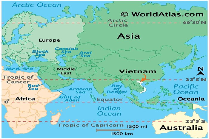
Nestled near the centre of Southeast Asia, Vietnam is the easternmost country on the Indochinese peninsula, covering an area of approximately 331,212 square kilometres. Shaped like a long, graceful S, it stretches about 1,650 kilometres from north to south, with its narrowest point at Dong Hoi in Quang Binh province, measuring just 50 kilometres wide. According to the Vietnam geography map, the country's terrain is remarkably diverse, with mountains and hills dominating roughly two-thirds of the mainland, while the Red river delta in the north and the Mekong river delta in the south offer fertile plains and a network of waterways and rice paddies.
In Vietnam map, we can see Vietnam’s total length is 1650 kilometres with a long coastline of 3260 kilometres from Mong Cai in the north to Ha Tien in the south, along with its maritime area spanning about 1.000.000 square kilometres in the East Sea, with more than 4000 islands, both large and small, underline its significant maritime rights and sovereignty.The tropical monsoon climate enhances this varied landscape, featuring hot and humid summers, mild winters, and clear distinctions between wet and dry seasons. Temperature variations between the north and south add to the regional diversity.
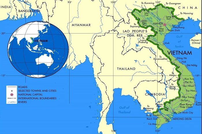
Vietnam’s natural landscape is both unified and complete, incorporating land, sea, and sky. It is divided into several distinct regions, including the mountainous areas, the Red river delta, the Truong Son Range, the Central highlands, and the Central coastal plain. High mountains occupy merely 1% of the territory, while plains and low-altitude hills account for up to 85% of the land. Despite its mountainous terrain, agricultural land constitutes less than 20% of the total area.
This diverse tapestry of landscapes seen on the map of Vietnam ranges from majestic mountains like Fansipan to lush valleys and pristine beaches, along with a rich biodiversity that includes rainforests, mangroves, and coral reefs, significantly enriches Vietnam's cultural heritage and tourism appeal. The elongated and narrow shape of the mainland, coupled with its winding, S-shaped coastline, contributes to the dynamic and vibrant nature of the country's regions.
Vietnam stands as an alluring destination for tourists, offering an array of attractions that range from vibrant urban centers to tranquil natural settings on Vietnam map. Embark on an unforgettable journey through Vietnam's rich landscapes, historic sites, and lively culture, guided by a Vietnam travel map that opens doors to diverse experiences.
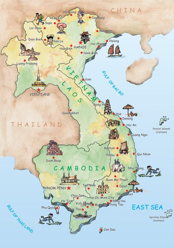
Starting in the northern region, the energetic capital of Hanoi captivates with its colonial architecture, bustling markets, and renowned sites such as the Temple of Literature and Ho Chi Minh Mausoleum. A short journey away lies Ha Long Bay, a UNESCO World Heritage Site famous for its spectacular limestone karsts emerging from the emerald waters, ideal for boat tours and kayaking. For those seeking the allure of the highlands, Sapa offers stunning terraced rice fields, traditional hill tribe villages, and treks to Fansipan, the tallest peak in Indochina.
On the Vietnam tourist map, Central Vietnam enchants visitors with its historical depth and scenic beauty Hue, once the imperial capital, is home to the majestic Forbidden City and ancient royal tombs, whispering stories of past dynasties. Nearby Da Nang mixes contemporary vibrancy with natural wonders, including pristine beaches and the scenic Marble Mountains, while Ba Na Hills boasts breathtaking vistas. Hoi An, preserved as a UNESCO World Heritage Site, delights with its old-world charm, colourful vibrant lantern-filled streets, and bespoke tailoring shops…always captivating tourists all over the world.
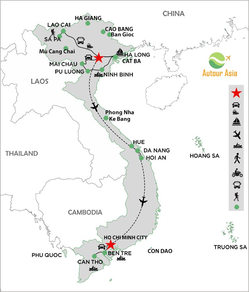
Travelling south Vietnam, the dynamic Ho Chi Minh City offers a stark contrast with its bustling streets, historical landmarks like the War Remnants Museum, and colonial structures. The Mekong Delta, with its expansive network of rivers and rice paddies, provides a unique insight into the rural Vietnamese lifestyle through boat tours and vibrant floating markets. For beach lovers, Phu Quoc beach or Con Dao island is the most ideal destination, providing a perfect escape with its immaculate shores, excellent diving spots, and luxurious mud baths.
This overview highlights the captivating destinations waiting to be discovered on a Vietnam tourist map. From the historical and cultural richness of the north to the stunning beaches and natural beauty of the south, each region promises an unforgettable experience. Start planning your trip and prepare to be enchanted by the magic of Vietnam.
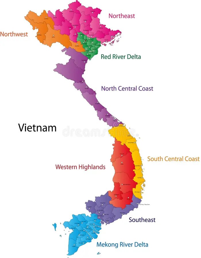
The North on map Vietnam encompasses a diverse range of landscapes and cultures, stretching from the capital Hanoi to the mountainous border with China, with a total of 25 provinces and cities, offers a fascinating blend of history, culture, and breathtaking natural beauty, making it a captivating destination for all travellers.
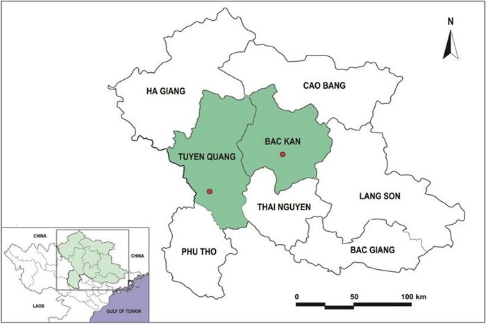
Northeast Vietnam includes 8 provinces: Tuyen Quang, Thai Nguyen, Phu Tho, Ha Giang, Cao Bang, Lang Son, Ban Kan, Bac Giang. Perhaps the outstanding feature of the mountainous terrain of the Northeast is the low-altitude hills and mountains (less than 1000 m) that account for most of the region. On the geographical map of Vietnam, the terrain of this area has the common characteristic of gradually tilting from Northwest to Southeast. The northeastern hills and mountains lie east of the Red river valley. Tourists often choose a circular route that is also the main direction of the mountainous terrain to explore as much as possible of the Northeast loop route. This place always attracts tourists with tourist attractions that cannot be missed when coming to Vietnam such as Ha Giang and Cao Bang with many special historical and cultural attractions. This land is also a diverse cultural mix between the Tay, Nung, Lo Lo,...
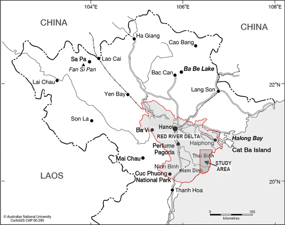
On map of Vietnam, the Northwest of Vietnam, comprising 6 provinces: Son La, Yen Bai, Dien Bien, Lai Chau, Hoa Binh, and Lao Cai, known as the region with the most rugged topography but also the most worth conquering in Vietnam. The terrain in the Northwest is high and deeply divided, with many massifs and high mountain ranges running in the northwest-southeast direction. Renowned for its features of a mountainous landscape, consistently cool climate, diverse natural beauty and the vibrant cultures of more than 20 ethnic minorities like the Thais, H'Mong, Muong, and Dzao,...the area draws numerous tourists as an ideal destination for hiking, trekking… Unlike conventional luxury tourism, the northwest is celebrated for its ecotourism, offering visitors a retreat into nature away from urban life, where they can experience the hospitality of ethnic communities and their unique, colourful attire.
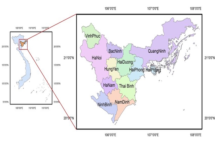
The Red River Delta is a vast region surrounding the Red River basin in Northern Vietnam. It is one of the most developed areas in the country, not only in tourism but also in various other sectors. We can use the Vietnam map to find that this is the largest area in the country (more than 331,000 square kilometres) with flat terrain and a dense river system, which has created favourable conditions for the development of the region's transportation system and infrastructure. Looking on Vietnam travel map, this area has 11 provinces and cities that always attract a large number of tourists to stop when coming to Vietnam because this place gathers many places that cannot be missed such as the capital Hanoi, HaLong bay - a world heritage site or “its sister” Tam Coc - Ninh Binh,... and many other attractions are always waiting for your trip. This region is primarily inhabited by the Kinh people, the largest ethnic group in Vietnam, along with some Thai and Muong communities in neighbouring areas.
If you look at the Vietnam geography map, you can see the north central Vietnam, stretching from Thanh Hoa to Thua Thien Hue, is distinguished by the eastern slopes of the Truong Son Range. This majestic mountain range and its lush forests create a breathtaking landscape, renowned for its stunning caves, particularly in Quang Binh, which is famously known as the "Kingdom of Caves." The region is also traversed by significant rivers, including the Ma river, Cariver, and Huong Rivers. These rivers form fertile deltas that are perfect for agriculture and offer picturesque settings for river cruises. Additionally, the North Central region boasts long stretches of pristine white sand beaches with clear blue waters, consistently attracting tourists to its shores.
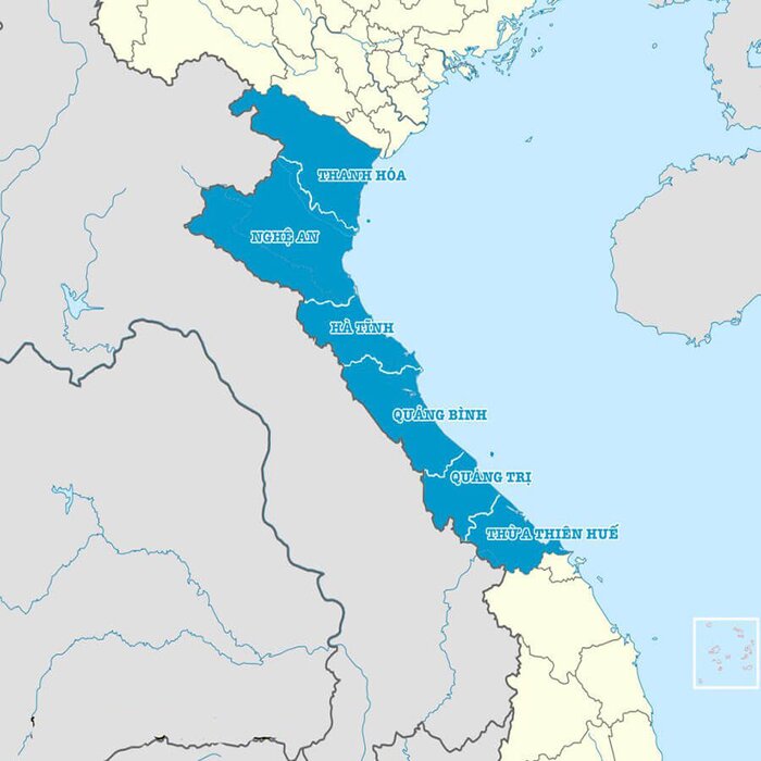
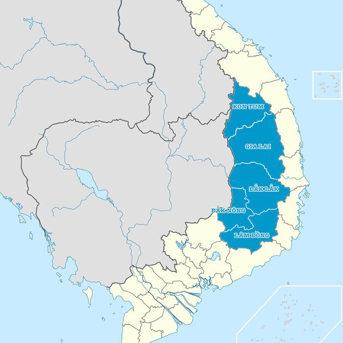
The Vietnam Central Highlands (Tây Nguyên in Vietnamese) has a total area of about 54,476 square kilometres, located on the geographical map of Vietnam to the west and southwest of Central Vietnam (west of the Truong Son range). The Central Highlands borders Laos and Cambodia to the West, the South Central economic region to the East and the Southeast region to the South. The terrain of this region is extremely diverse and complex, mainly plateaus and high mountains with altitudes from 250 m to 2500 m, characterised by basalt red soil. This is considered the cradle of production and development of Vietnamese tea, pepper or coffee for export to foreign countries. It is also home to a number of Vietnamese ethnic minority communities such as Ba Na, Ede, Gia Rai…
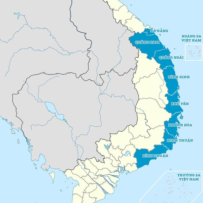
Vietnam travel map reveals that the South central coast of Vietnam, spanning from Da Nang to Binh Thuan, is a region distinguished by its diverse and captivating geography. This part is located on the geographical map of Vietnam and belongs to the coastal zone. In fact, the terrain of the Central Coast includes coastal plains and low mountains with an estimated width of about 50 km. Certainly narrower than the north Central and Central Highlands, this area combines the rugged beauty of the eastern slopes of the Truong Son range with fertile coastal plains and pristine beaches, creating a dynamic and picturesque landscape. Iconic beaches include My Khe Beach in Da Nang, An Bang Beach in Hoi An, and the stunning bays, all ideal for sunbathing, swimming, and water sports.
South Vietnam forms a crucial part of the country of Vietnam. This region occupies the southern portion of Vietnam and is strategically bordered by the Gulf of Thailand to the west, the East Sea to the east and southeast, and Cambodia to the north and northwest. This geographic positioning endows South Vietnam with a variety of landscapes, encompassing bustling cities, lush deltas, and scenic coastlines.
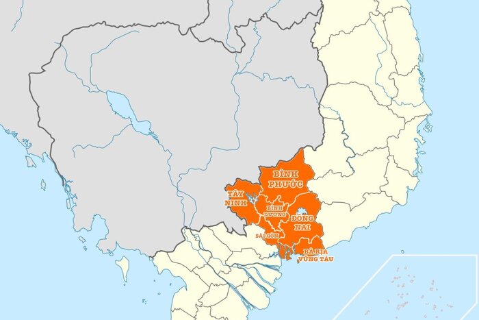
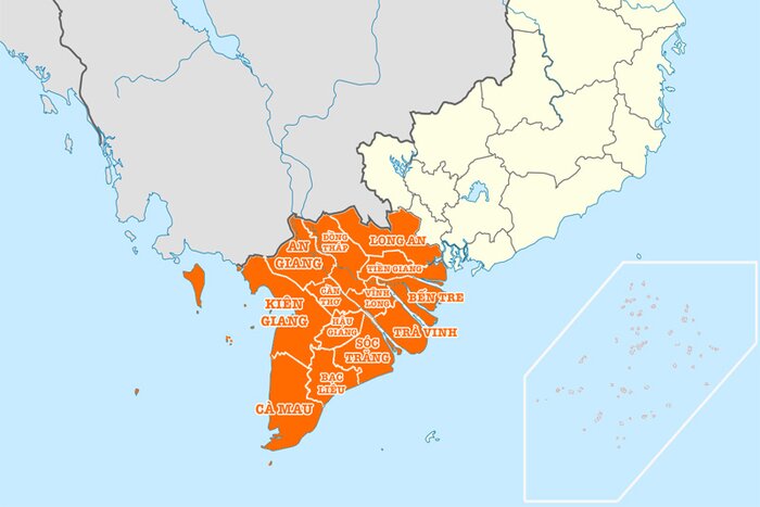
Southern Vietnam can be broadly divided into two distinct regions, according to the Vietnam map and each offering unique experiences. The southeastern region sits on a wide plain, transitioning from the mountainous majesty of the South Central Highlands to the fertile lands of the Mekong Delta. This area comprises 5 provinces and cities, including Ho Chi Minh City, a pulsating centre of commerce, culture, and history.
In contrast, the southwestern region (Mekong delta region) encompasses a vast delta formed by the mighty Mekong River. Here, 12 provinces and cities sprawl across a landscape characterised by its low elevation (averaging around 2 metres) and consisting primarily of newly formed alluvial deposits. While generally flat, pockets of low mountains can be found in the western reaches bordering Cambodia, particularly in An Giang and Kien Giang provinces. The Mekong River and its tributary, the Dong Nai River, are the lifeblood of this region, nourishing the fertile plains and providing a vital transportation network.
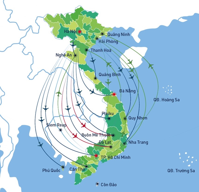
Vietnam's extensive airport network spans the entire country from North to South, featuring numerous prestigious airlines such as Vietnam Airlines, Vietjet Air, Jetstar Pacific,... that offer a wide range of destinations and flight schedules. This robust infrastructure not only enhances domestic tourism but also facilitates travel within Southeast Asia and globally, ensuring that travelers can always enjoy unforgettable journeys.
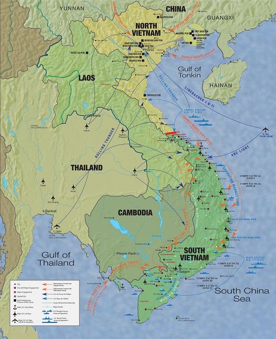
> Answer: A detailed Vietnam travel map helps in understanding the geography, planning routes, and identifying key attractions in each region. It is essential for organising an efficient travel itinerary and ensuring you don't miss any important sights.
> Answer: Yes, maps of Vietnam are often available in several languages, including English, French, German, and Japanese, catering to international tourists.
> Answer: Digital versions of Vietnam maps are widely available and can be accessed through various travel apps (the most famous is Google map), websites, and downloadable PDFs, offering convenience for tech-savvy travellers.
Unfold a Vietnam map and discover a captivating tapestry of landscapes, cultures, and experiences. This diverse country promises an unforgettable journey, so pack your bags and embark on your Vietnam adventure! To ensure your journey is tailored to your preferences, we are pleased to offer our assistance in creating a customised itinerary. Please do not hesitate to Autour Asia - best Vietnam travel agency for a complimentary consultation.


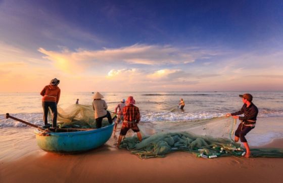
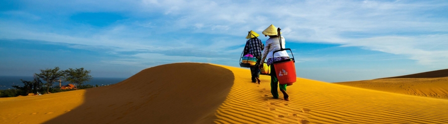
Phan Thiet, a coastal city in Binh Thuan Province, is best known for Mui Ne, an internationally renowned seaside destination. With its beaches, fishing villages, and desert-like sand dunes, the region offers a diverse range of landscapes rarely found elsewhere in Southeast Asia. In November, temperatures remain pleasant for exploring the coast, although occasional showers are still possible. Visiting Phan Thiet Mui Ne in November requires a little preparation to make the most of your stay. This complete guide covers the weather, must-see attractions, transportation options, and practical tips to help you plan your trip to Vietnam in November.
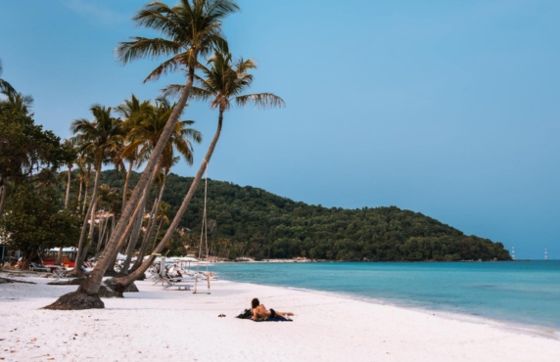
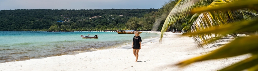
Vietnam’s beaches are best enjoyed at different times of the year, depending on the region. From the turquoise waters of the South to the long stretches of white sand in the Central region and tropical islands, each area has its own climate patterns. To better understand when to visit Vietnam, it is important to consider the weather conditions in each destination. The best time to visit beaches in Vietnam depends on region you choose as well as the activities you have planned. The best time to swim in Vietnam also varies according to rainfall, water temperature and sea conditions. Understanding the Vietnam beach season helps you choose destinations that match your travel dates and enjoy the coastline in good conditions.
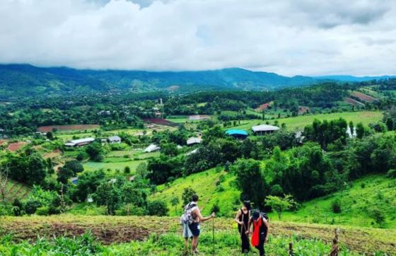
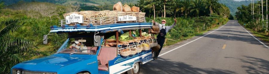
Discovering Thailand through its rice fields, plantations, and rural villages offers a different way to travel, far from traditional tourist circuits. But how can you choose the best agency for Thailand farm tours to enjoy authentic experiences with local communities? Several tour operators offer trips combining agriculture, gastronomy, and encounters with producers. Among them, Autour Asia is an option for travelers who want to personalize their itinerary. Known as Vietnam travel agency - Autour Asia, the company also offers tailor-made trips to several countries in Southeast Asia. With the local travel agency in Thailand - Autour Asia, travelers can explore a trip designed around their interests. Here are five organizations worth knowing, their distinctive features, and the essential criteria for planning a successful agricultural tour in Thailand.
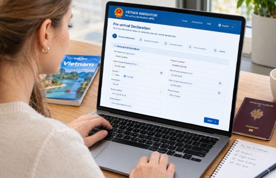
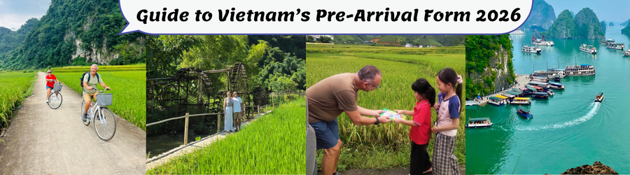
Planning a trip to Vietnam? Before packing your bags, take a few minutes to check the latest entry requirements and prepare the documents you may need at the airport.
Vietnam’s Pre-Arrival Information (PAI) system allows international travellers to submit selected personal, visa and travel details online before arriving in the country. After a successful submission, the system generates a QR code that travellers can save on their phones or print for use during immigration procedures. Although the online declaration is designed to help make arrival procedures smoother, travellers should understand when it applies, how to complete it correctly and which documents they still need to enter Vietnam.
In this practical guide, you will discover where to access the official PAI portal, what information to prepare, how to complete the declaration step by step, how to correct common mistakes and what to do when you arrive at the airport.
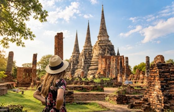
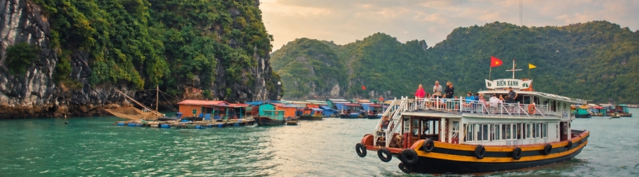
With its exotic landscapes, fascinating cultures and diverse experiences, Vietnam and Thailand are among the most popular destinations in Southeast Asia. However, safety remains an important criterion when planning your trip. So, how can you choose Vietnam or Thailand for a safe trip depending on the way you travel ? And is Vietnam safer than Thailand ? Each destination has its own characteristics and points to consider. In this article, Autour Asia helps you compare Vietnam and Thailand to better understand their differences and choose the destination that meets your expectations for your next trip to Asia.
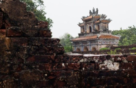
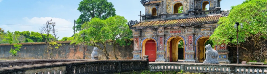
Planning a trip to Hue in November requires a little more flexibility than at other times of the year. Visiting Hue in November means experiencing the rainy season in central Vietnam, with prolonged showers and a risk of flooding. However, this period can also be an opportunity to explore the former imperial capital’s royal heritage, pagodas and renowned cuisine in a quieter atmosphere. The key is to choose your activities carefully, prepare alternative plans and check the weather conditions before setting out.
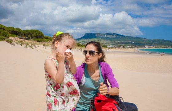

When travelling in Cambodia, some everyday habits may raise questions about local customs. Is blowing your nose in public considered polite? How should you behave in restaurants, on public transport or during a visit? These small details matter when you want to respect the local culture. Discover how to manage blowing your nose in Cambodia discreetly, along with practical tips on using tissues during your trip. Autour Asia, Cambodia travel agency, helps you discover local customs with advice tailored to travellers. From Cambodia travel etiquette to personal hygiene and everyday situations, a few simple guidelines can make your journey more comfortable. In Phnom Penh, Siem Reap or Kampot, understanding local customs helps you avoid awkward moments while making the most of your stay.
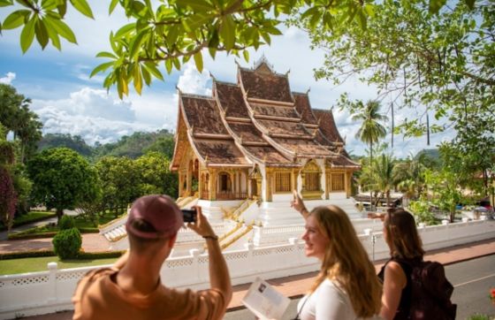
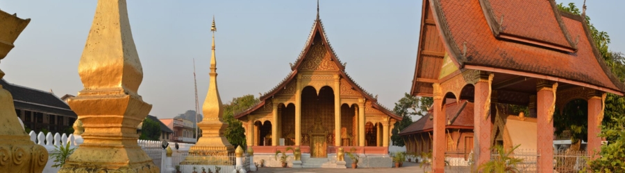
Blow your nose in Laos is not necessarily considered rude, but it is best to do so discreetly, especially in quiet places or during meals. If you have a cold, use a clean tissue and avoid blowing your nose loudly in public. In temples and other places of worship, respect the peaceful atmosphere and local customs. If you need to blow your nose frequently, step away from others for a moment whenever possible. Finally, dispose of used tissues in a rubbish bin. These simple habits will help you observe good manners during your trip to Laos.



 FR
FR EN
EN